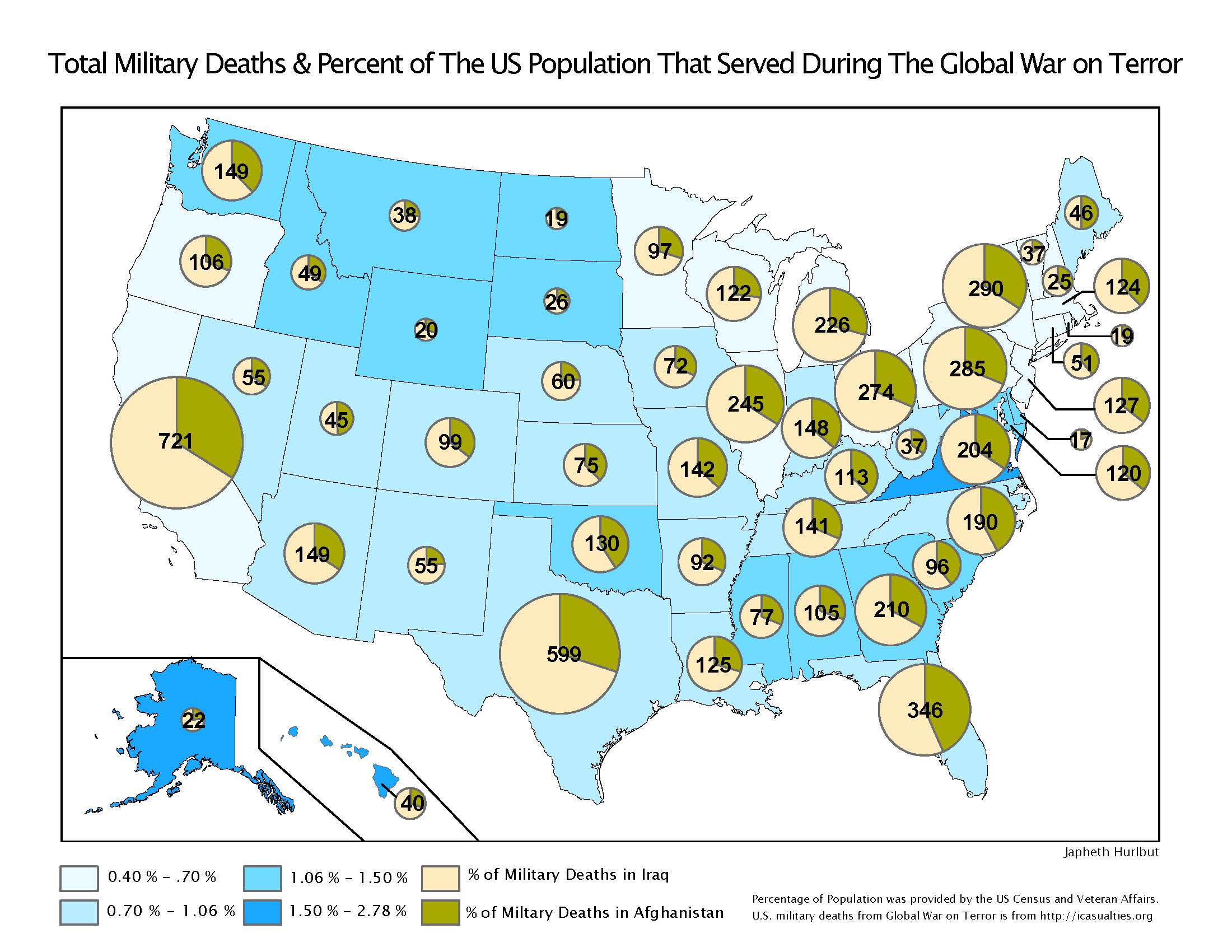
Total Military Deaths & Percent of The US Population That Served During the Global War on Terror
A multivariate map of the United States that depicts data collected by the Veteran Affair in 2013. A choropleth map of the US depicts the percentage of the population that has served in each state during the Global War on Terror and a corresponding pie chart with the total amount of service members who have died in action within Operations in Iraq or Afghanistan.
AZ National Parks Attendance Map
Arizona National Parks Attendance Map
An Arizona map depicting the National Parks attendance changes between 2001-2011 by percentage and the number of individuals attending the park in 2011 with graduated symbology
Phoenix City Council Socio-Economics Map
Phoenix City Council District Socio-Economics Map
A map of Phoenix, Arizona choropleth map depicting the median income tax bracket by census blocks. The map also depicts the different city council districts of Phoenix and a corresponding pie chart depicting the percentage of the different ethnic groups
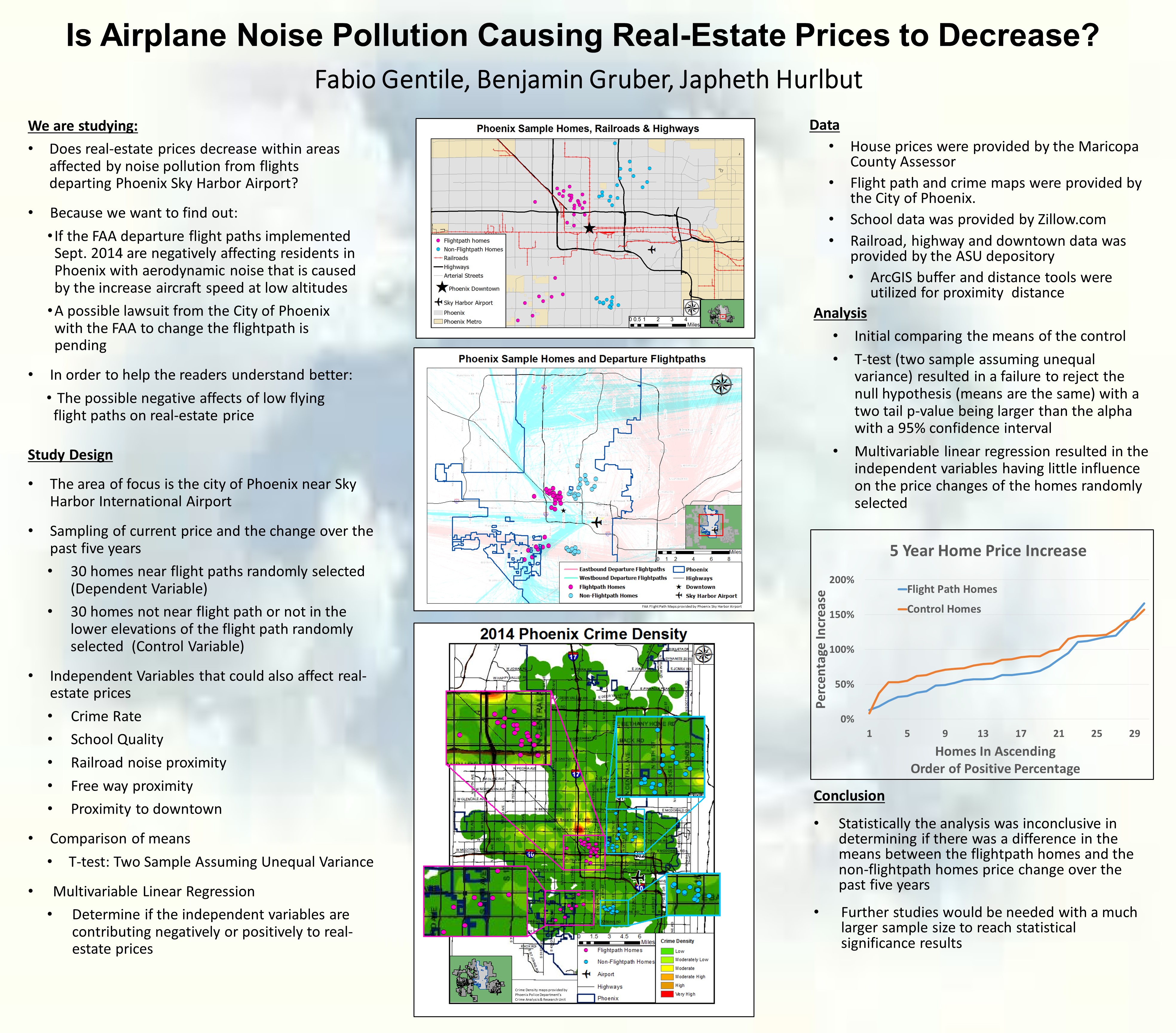
Phoenix Flight Path Project
New Phoenix Skyharbor Flight Paths Influence on Real-Estate Prices
Group project studying whether the new FAA flight paths were having a negative impact on housing prices within Phoenix.
ASU Map
Arizona State University Map
Digitized map based off aerial imagery.
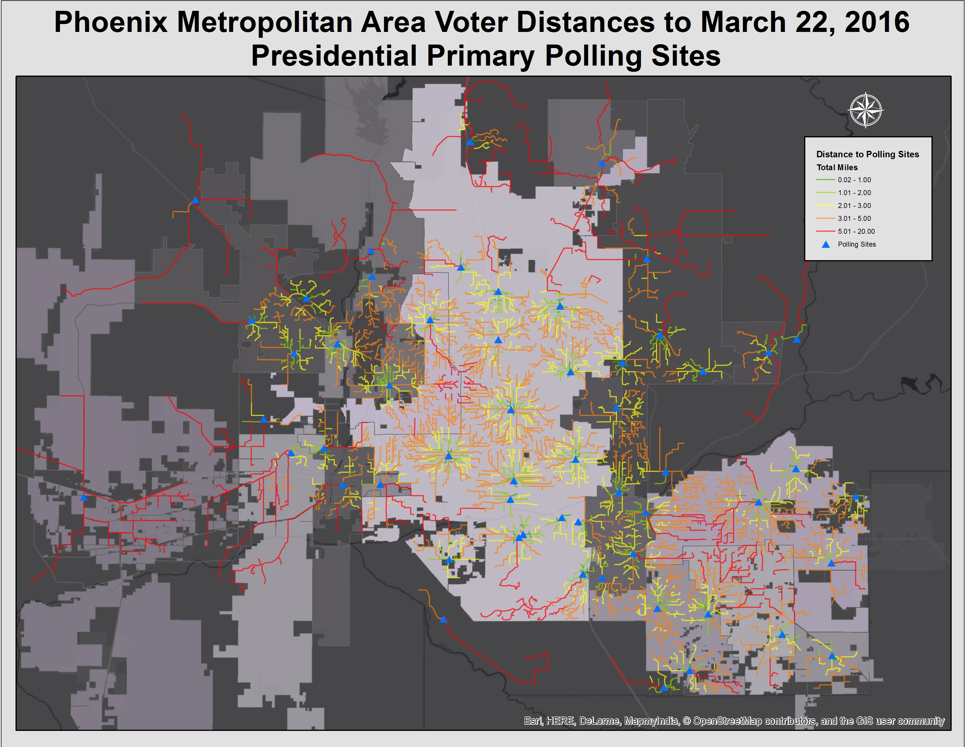
Polling Station Map
Phoenix Metro Area Voter Distance to March 22, 2016 Presidential Primary Polling Sites
Distance traveled to polling stations on March 22nd Presidential primary was created using Network Analyst Closest Facility tool in ESRI ArcMAP. The tool was utilized in depicting which census blockgroups went to what polling sites and how far voters traveled to vote.